

DYNAMIC CITY
*
GLYDWAYS *
DYNAMIC CITY * GLYDWAYS *
-
![]()
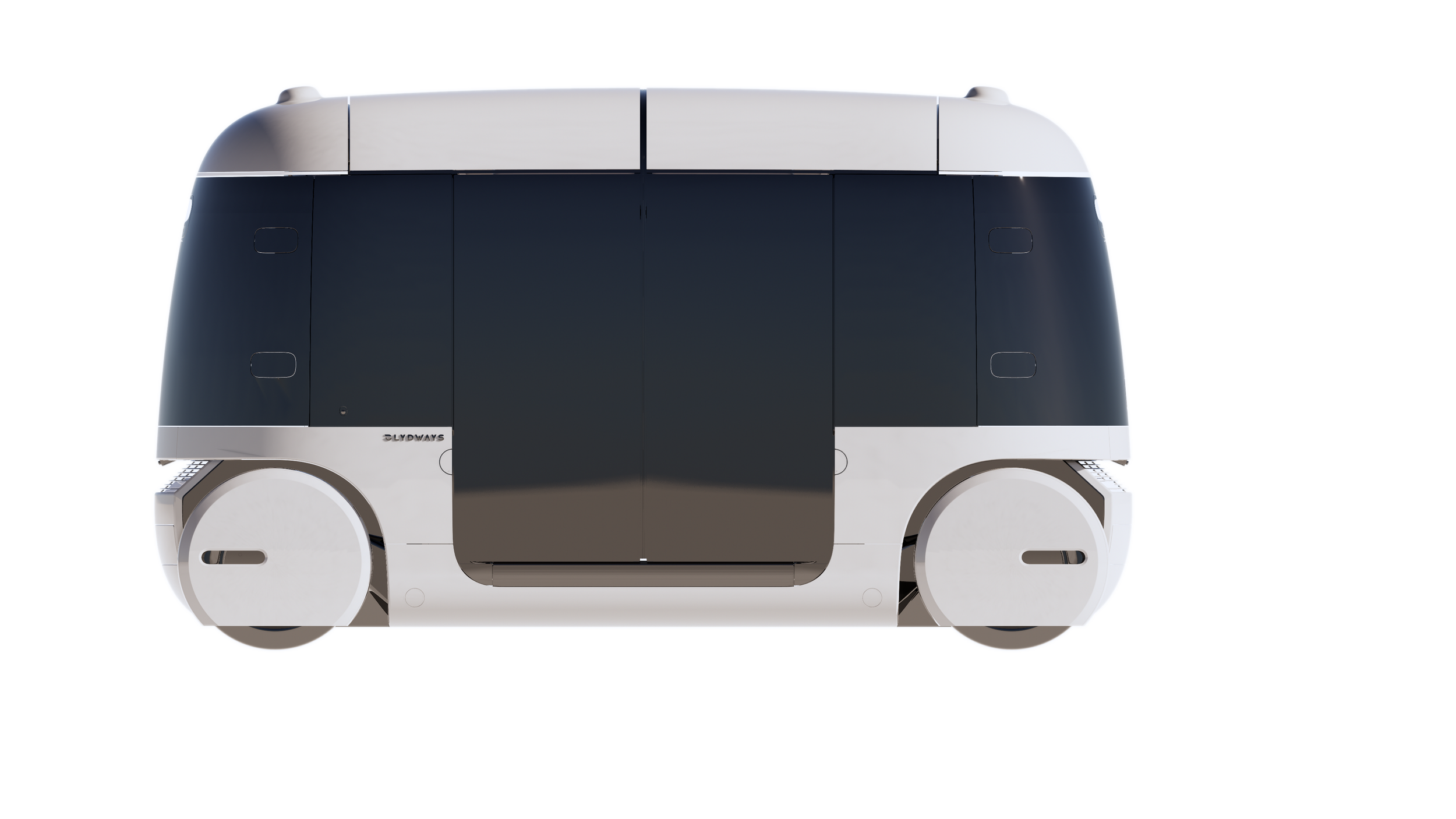
Glydcars
-
![]()
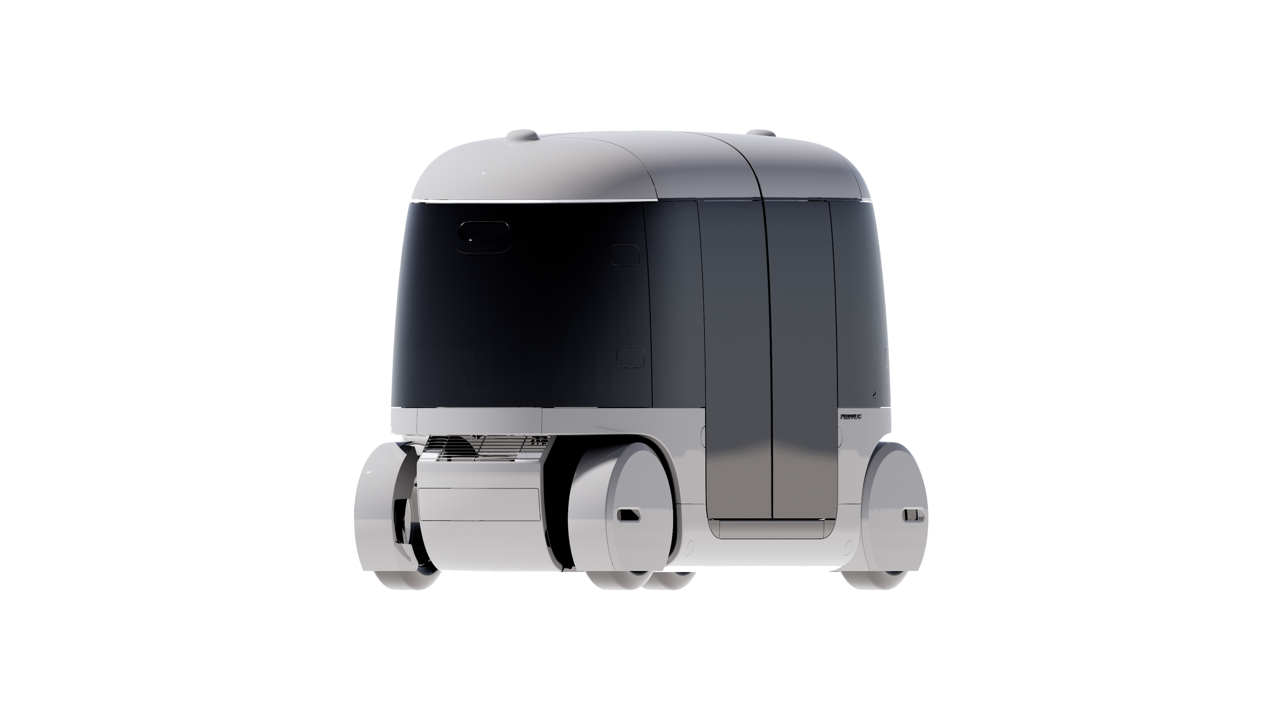
Glydcars
-
![]()
Glydcars

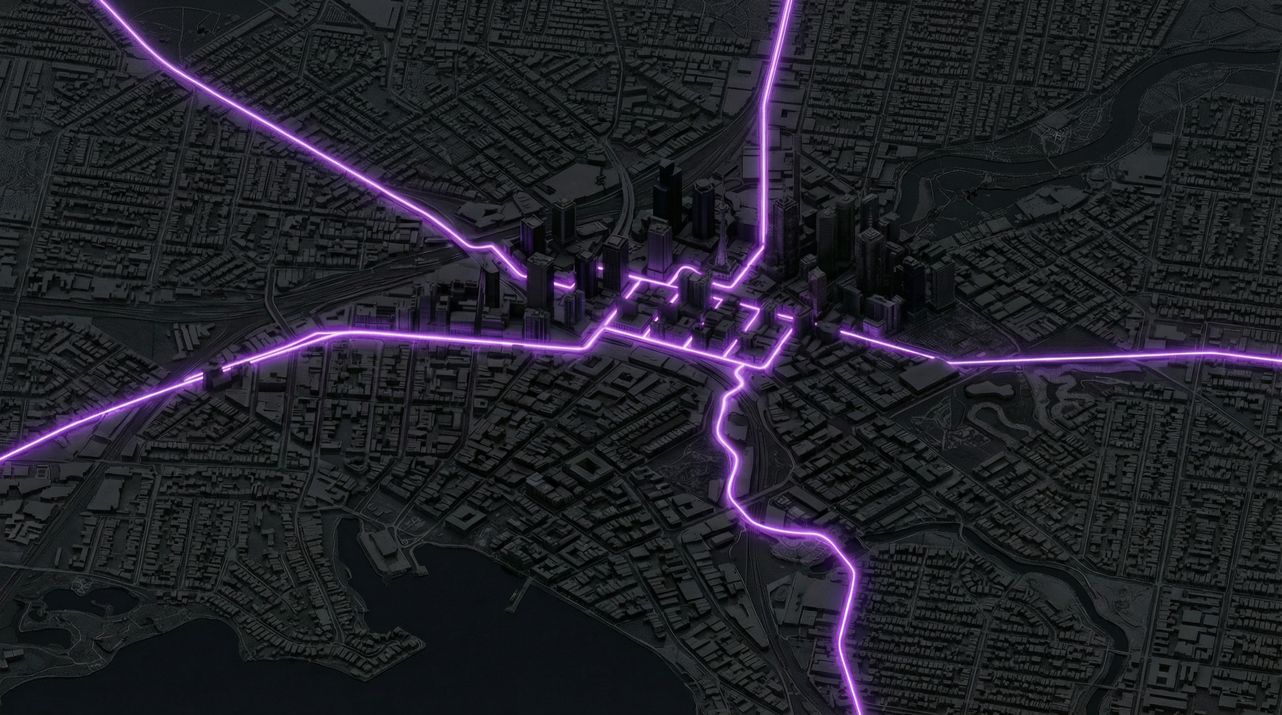
A computational corridor pratice for integrating a personal rapid transit (PRT) network into Melbourne, through parametric design and data-driven scenario analysis.
This project, undertaken at Glydways in my role as a system designer, investigates how a personal rapid transit (PRT) network could be integrated into Melbourne’s existing urban and infrastructure systems.
The work focuses on connecting Tullamarine Airport, the CBD transit nexus, and the Fishermans Bend renewal area through a computational, data-driven corridor study, using parametric workflows and scenario analysis to structure alignments, station locations, and system performance.
Glydways City Video
Mass Transit. Redefined
Into Melbourne’s urban fabric, connecting Tullamarine Airport to the CBD transit nexus and the Fishermans Bend renewal area
urban context & challenge
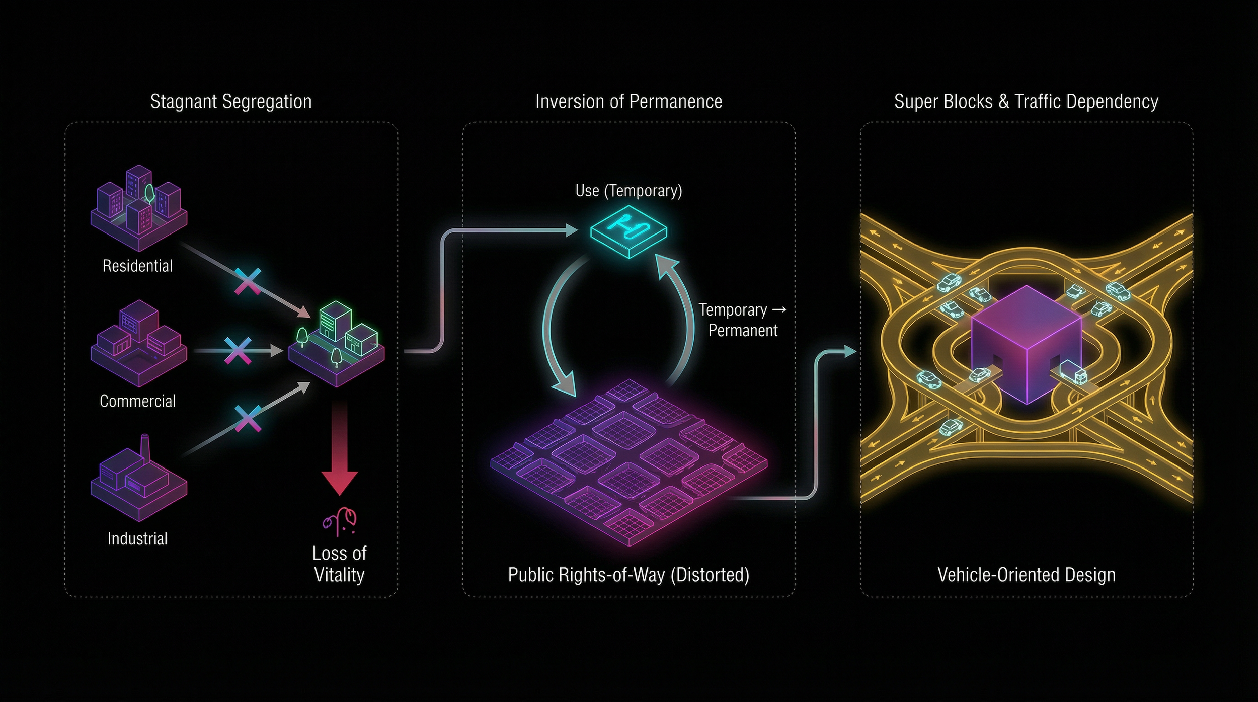
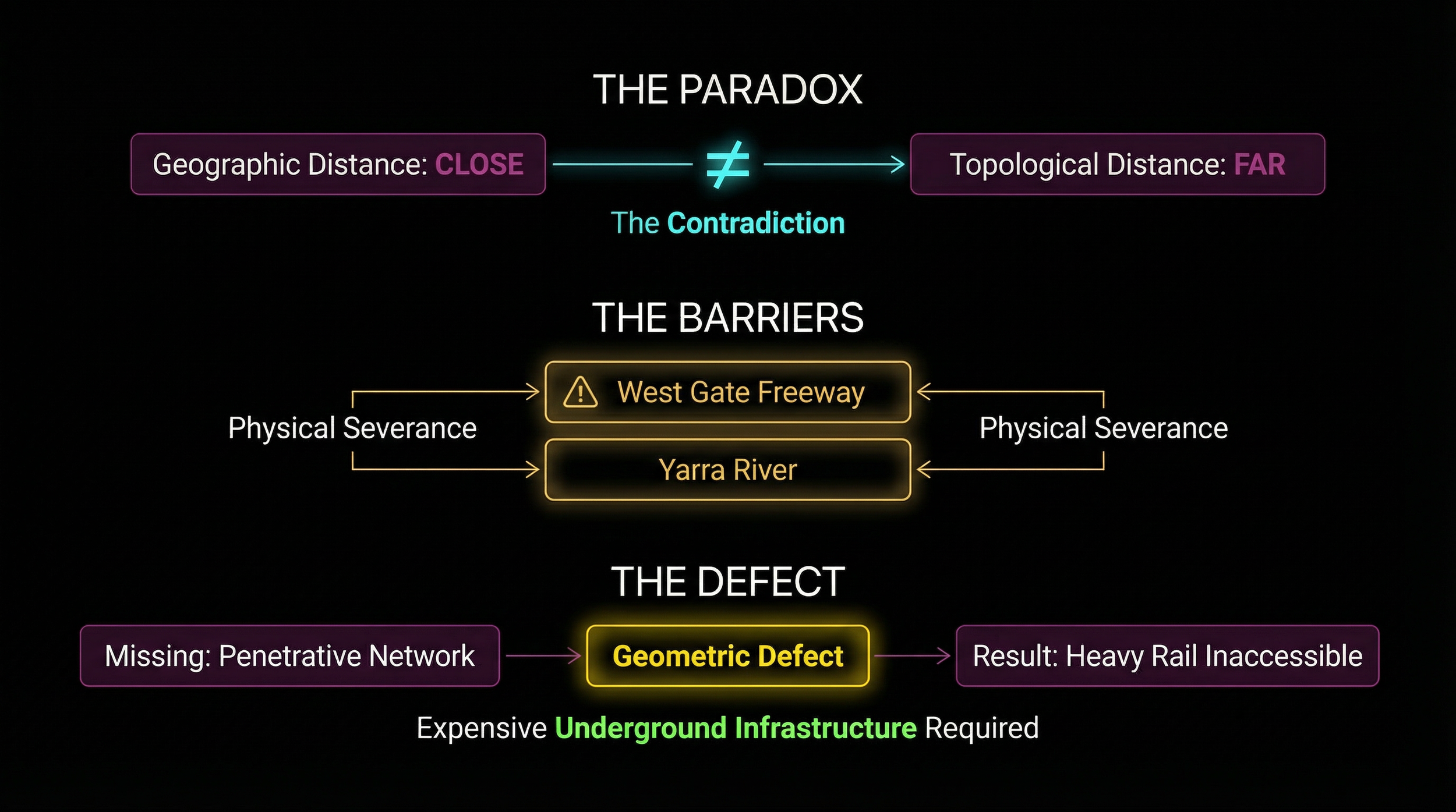
The Zoning critic
The chanllenge
TWO-Direction High Capacity
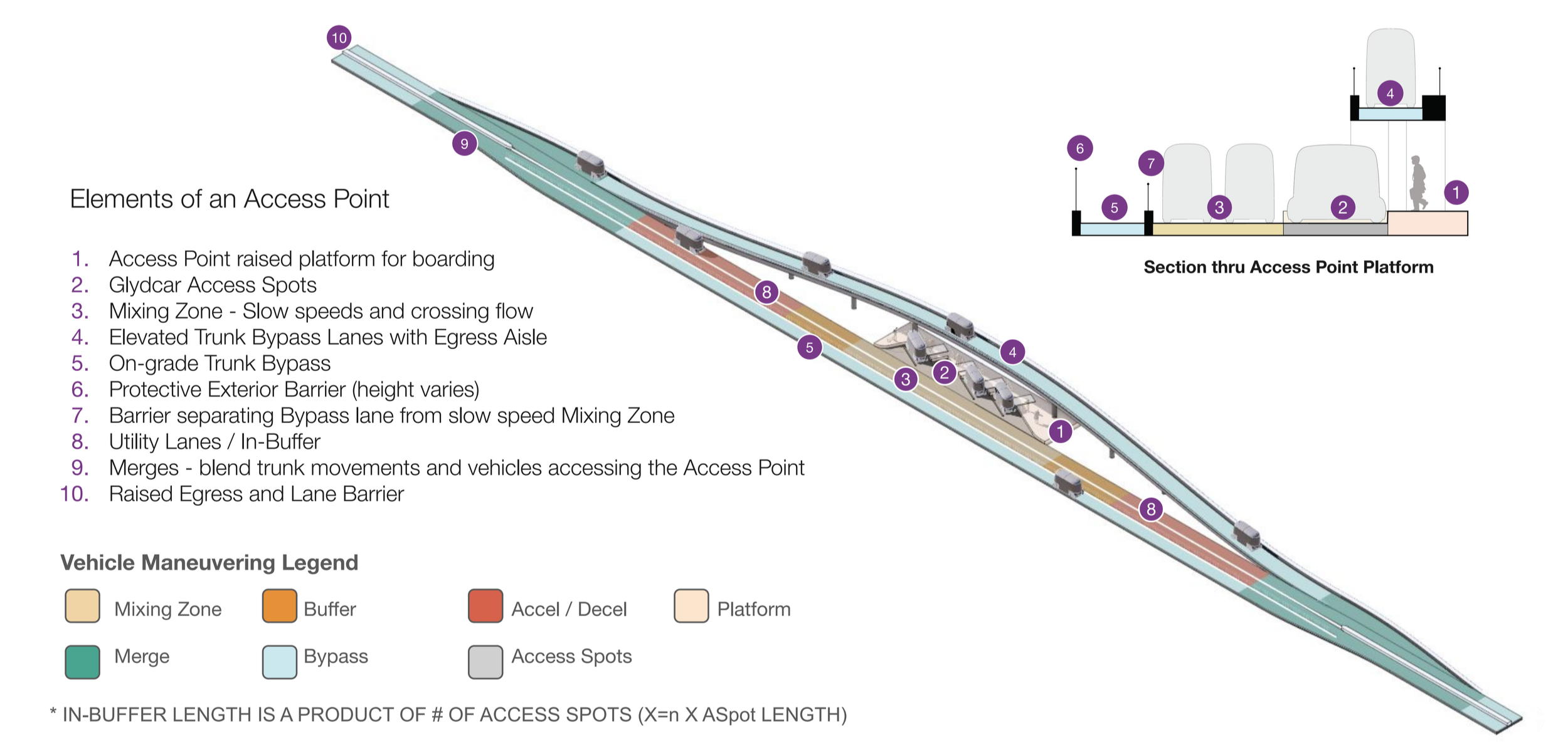
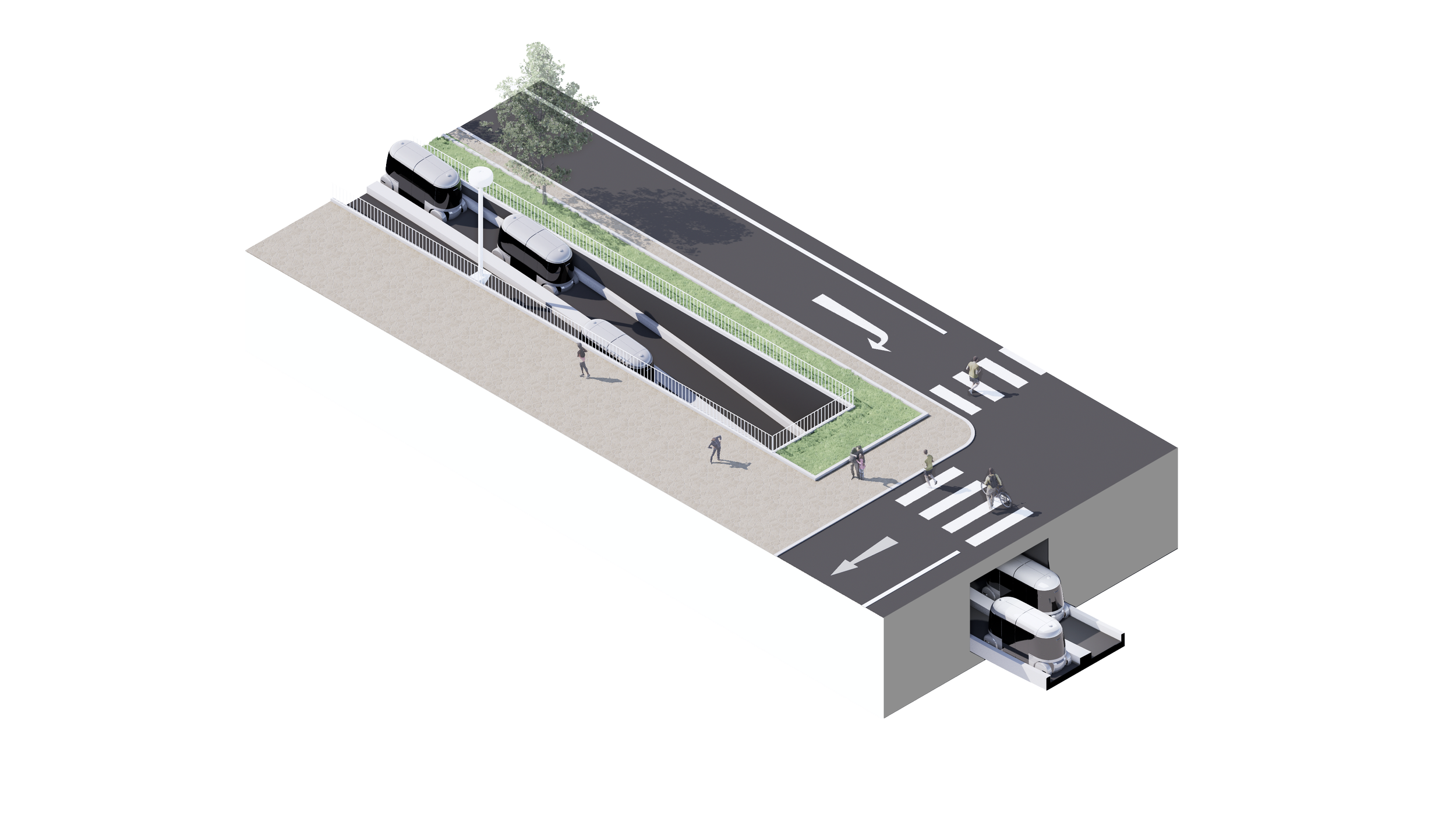
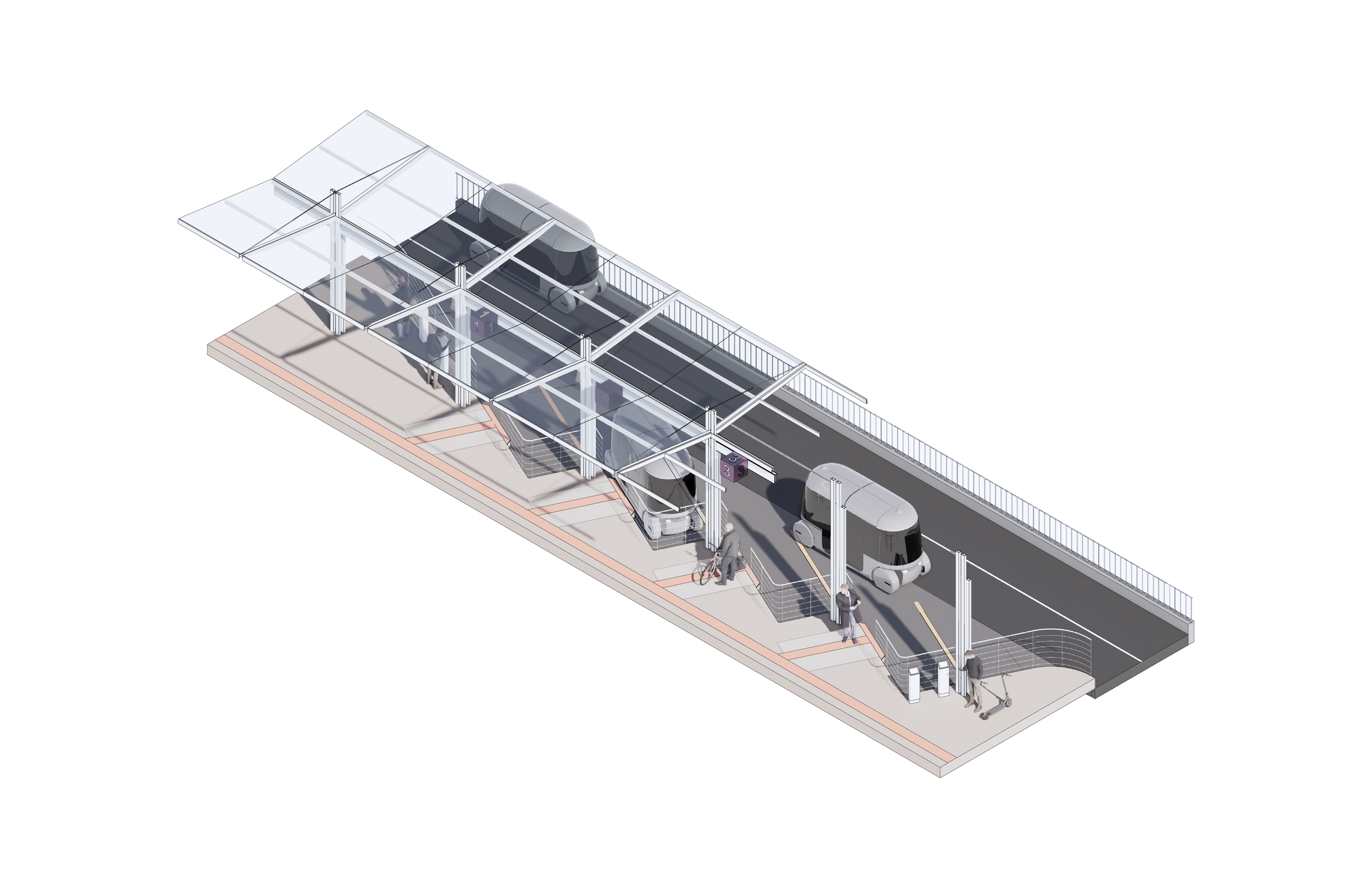
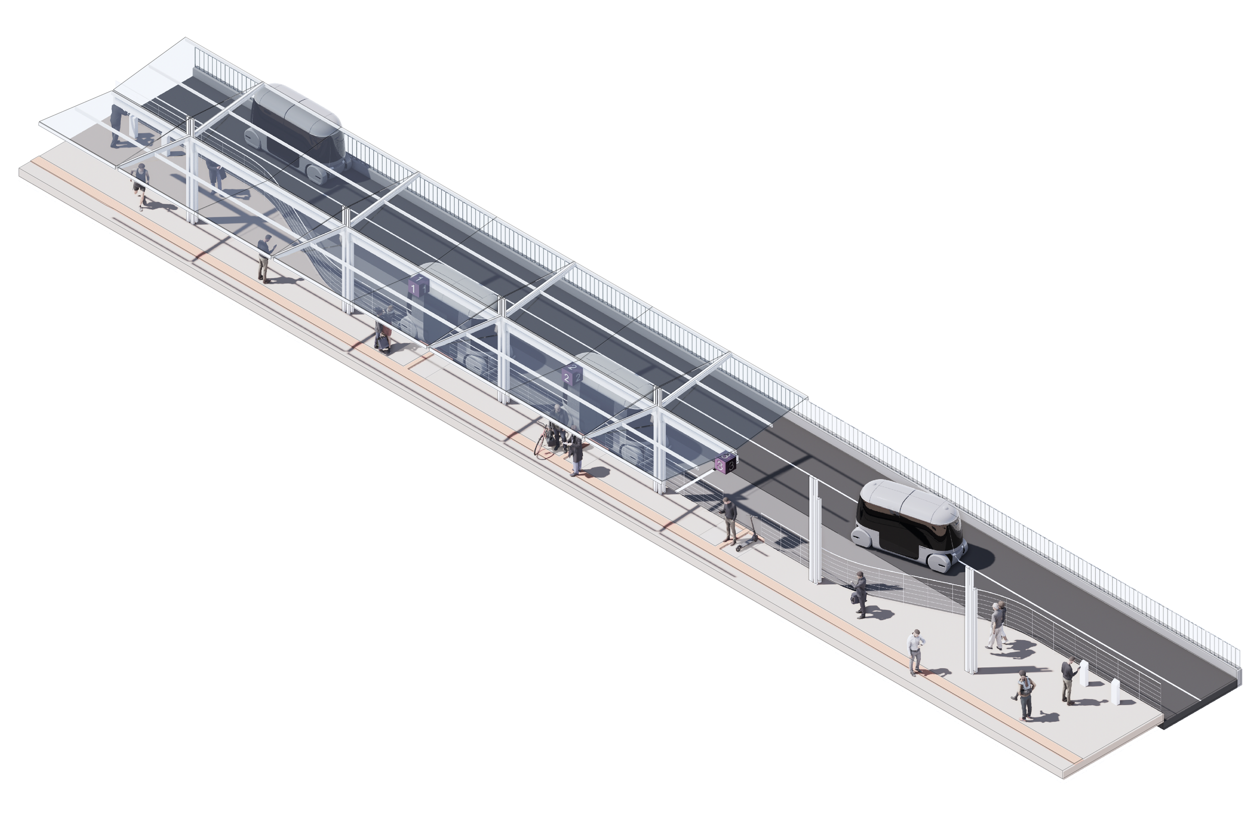
ACCESS POINT: anatomy
Step 1 computable Street Graph,
An end-to-end pipeline that goes from OSM street networks to hotspot corridor identification.
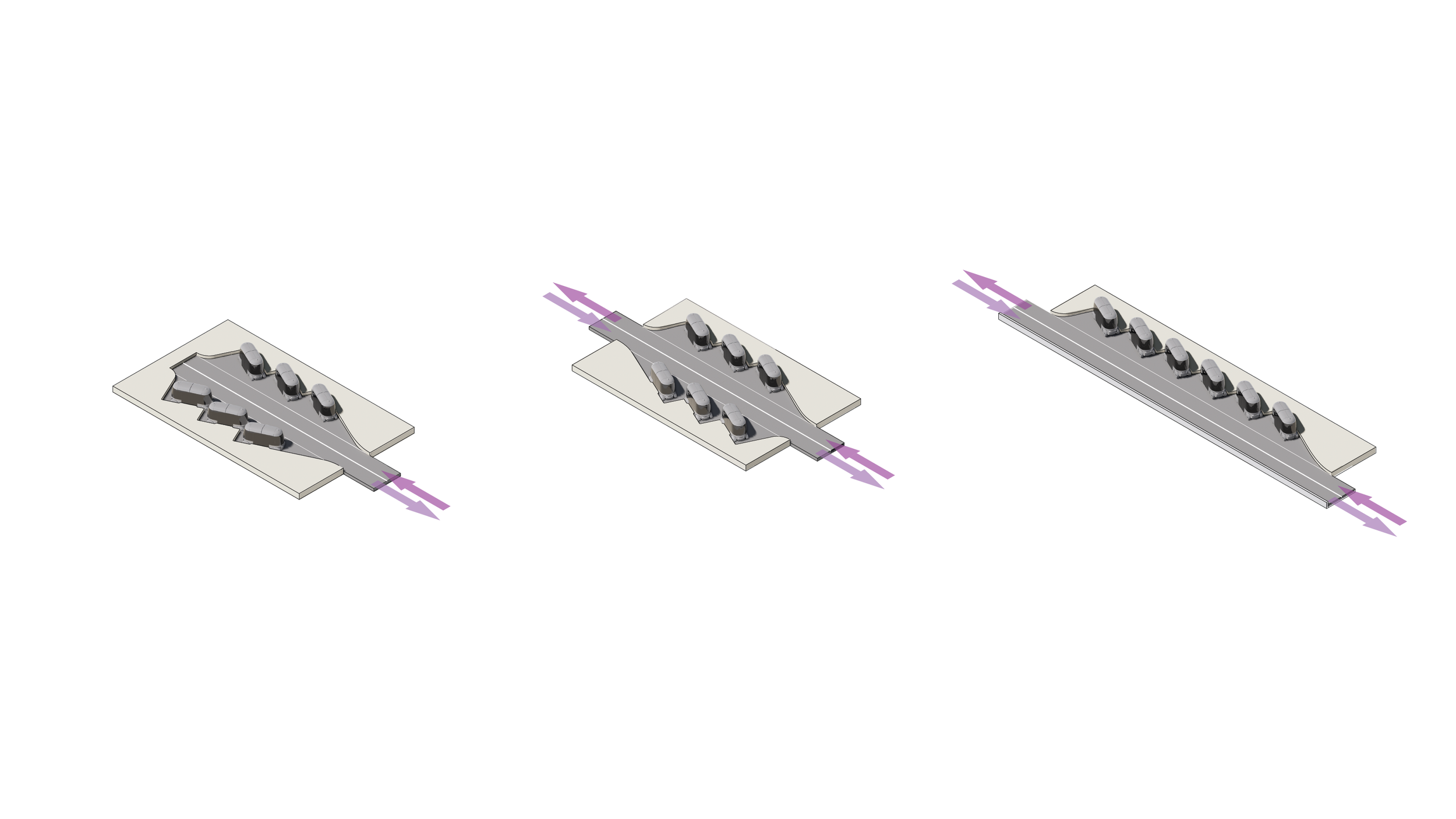
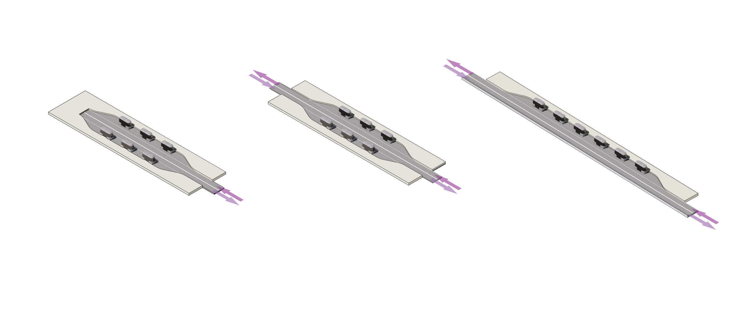
types of Guideway
-
![]()
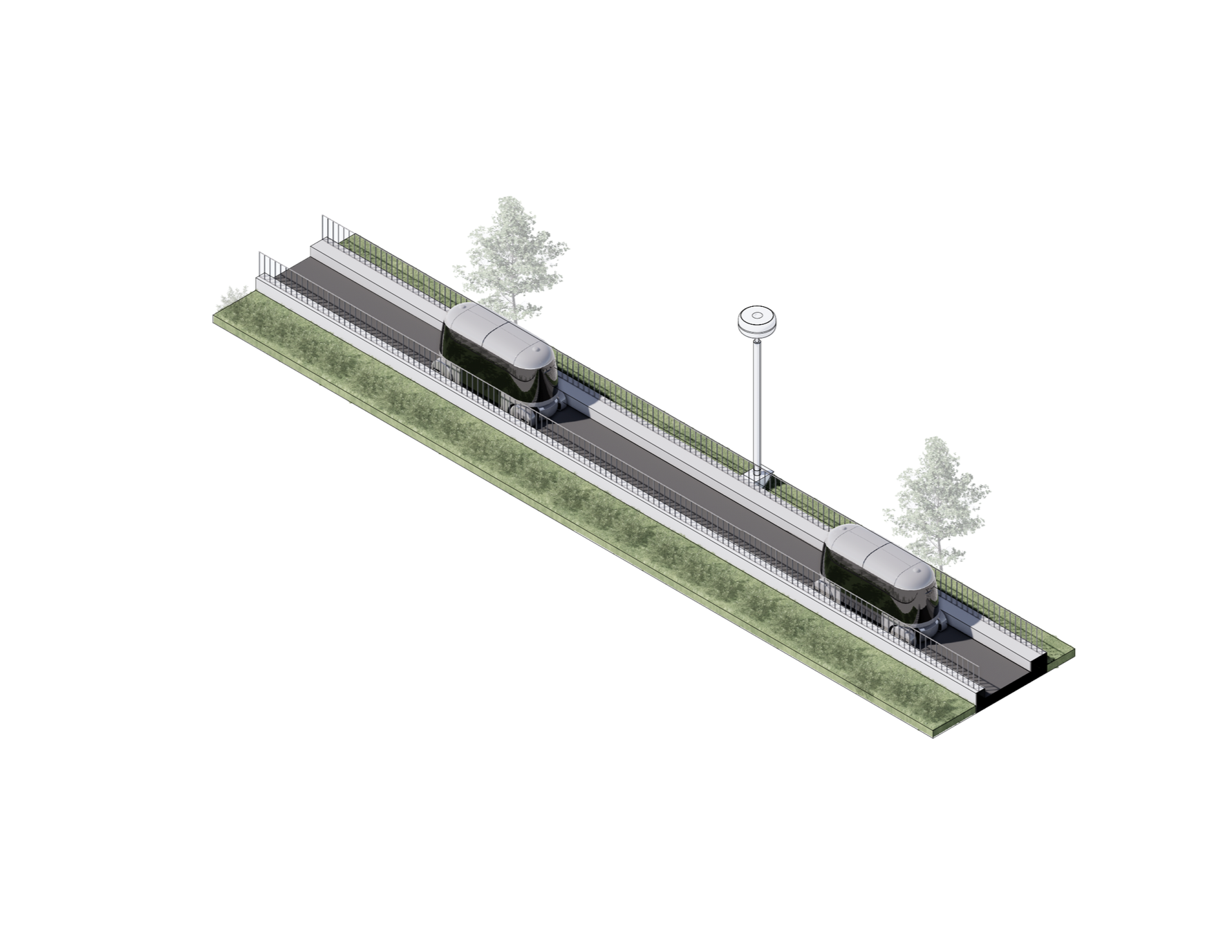
GUIDEWAY - GRADE
ONE WAY
-
![]()
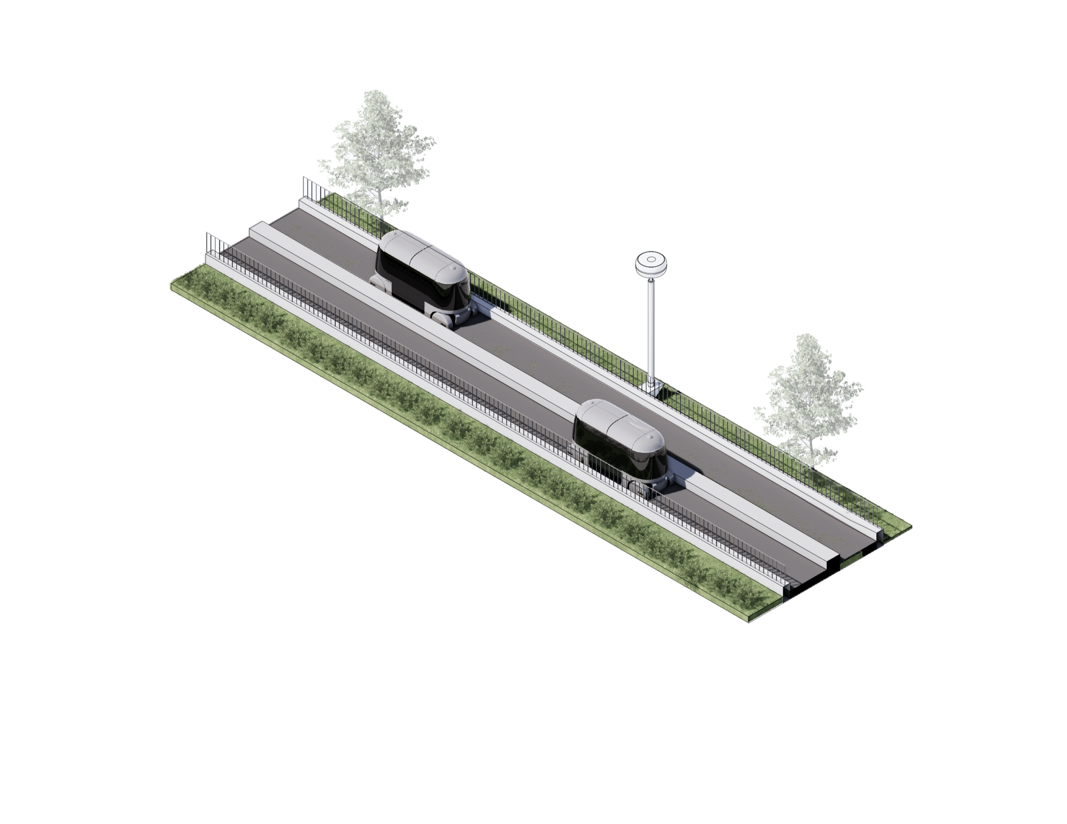
GUIDEWAY - GRADE
TWO WAYS
-
![]()
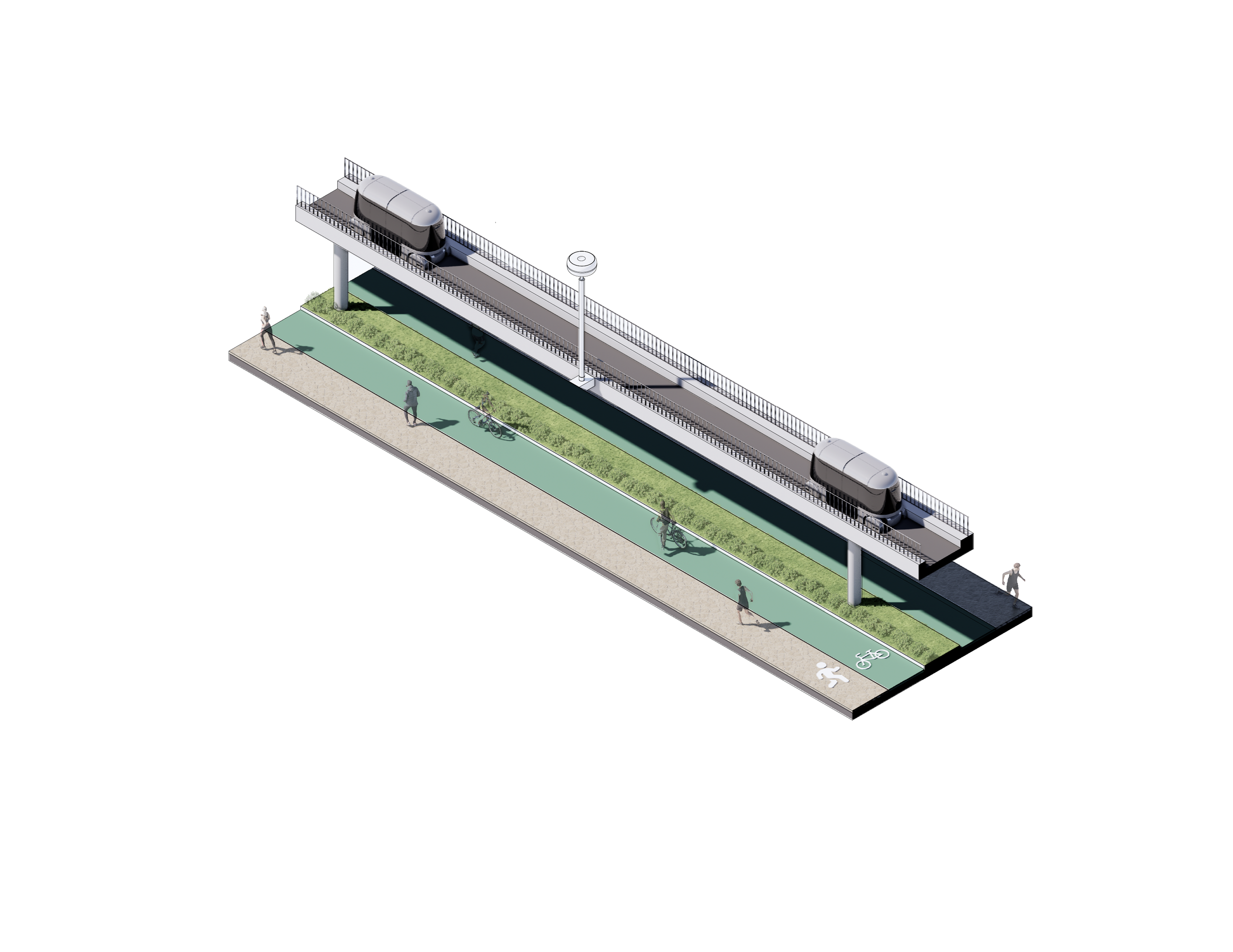
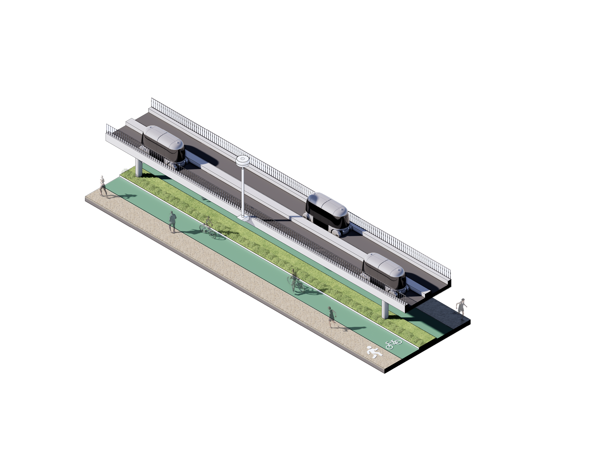
GUIDEWAY - ELEVATED
ONE WAT
-
![]()
GUIDEWAY - ELEVATED
TWO WAYS
-
![]()
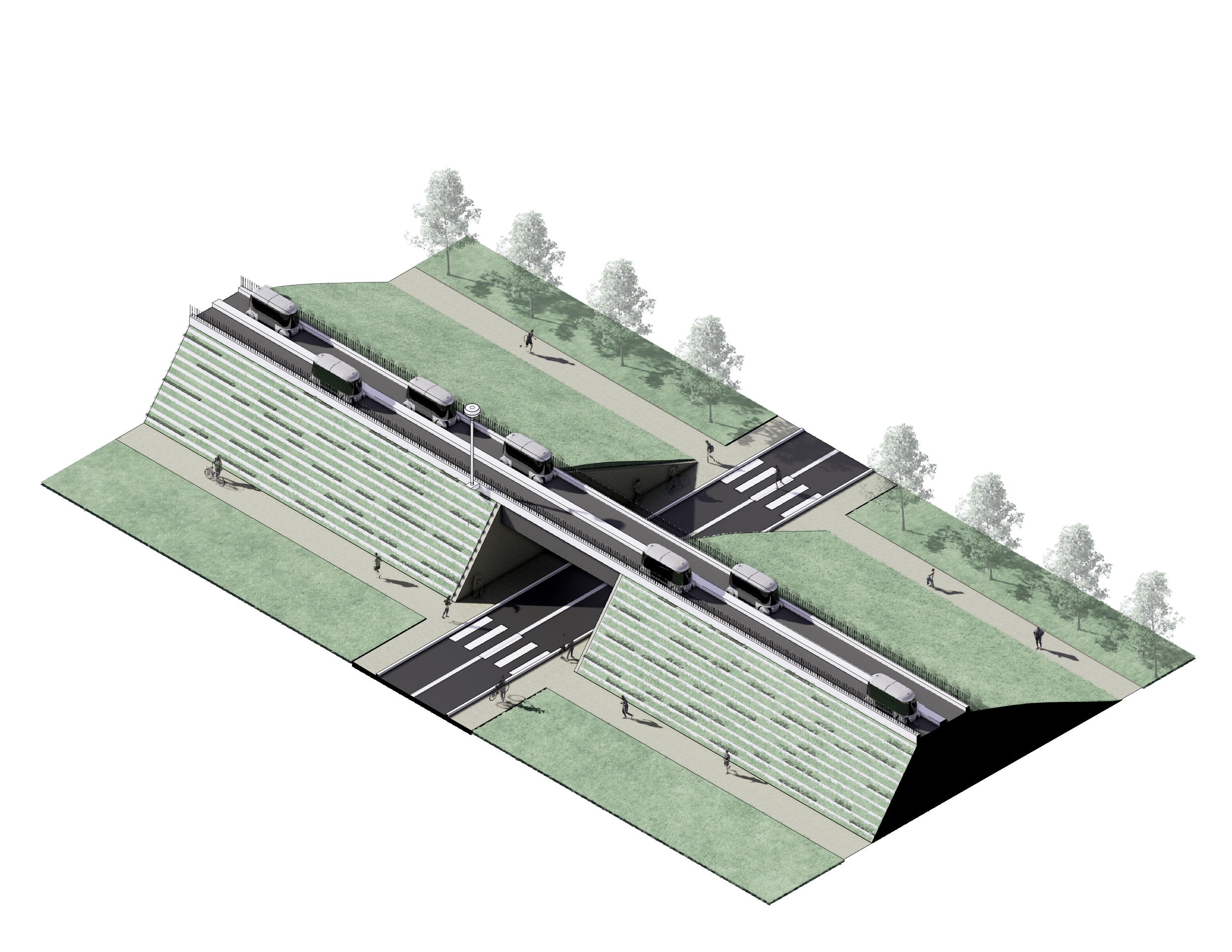
GUIDEWAY - BERM
TWO WAYS
-
![]()
GUIDEWAY - UNDERNETH
TWO WAYS
Step 2 Finding the Spine: Topological Analysis
Cost-aware topology and geometry optimization workflow
Step 2 Finding the Spine: Topological Analysis
Cost-aware topology and geometry optimization workflow
Step 2 Finding the Spine: Topological Analysis
Cost-aware topology and geometry optimization workflow
Step 3 evolving optimal station
Grasshopper handled the spatial geometry and visualization of candidate stations, while Python ran the genetic algorithm that searched for the best network.
-
Maximize coverage: reward layouts where at least 90% of high-priority nodes fall within a 400 m walkshed.
-
Minimize cost: reward shorter total guideway length between stations
-
If any station falls in a non-buildable area (like the river or restricted parcels), the score collapses toward zero.
AP - Angle Type
AP - parallel Type
Step 3 a non-linear,
mesh-like network
-
High-scoring layouts are selected to produce the next generation.
-
Through crossover, we combine parts of two strong “genomes” to create new candidate layouts.
-
Through mutation, for example using Python to randomly shift a station by 50 meters or swap it with a nearby candidate site, we test whether small changes can further improve the balance between coverage and cost.
Step 4 From Code to Reality: Operational Simulation
The front-end, where I design the station geometry and expose the key parameters as sliders: number of berths, vehicle headway, dwell time, vehicle capacity, peak-hour demand, etc.
And take those parameters and run a time-based simulation to see how the system actually behaves under stress.
-
Build a parametric model of the airport station in Grasshopper – berths, guideway, circulation – and control the operational assumptions with sliders (e.g. 4, 8, 12 berths; different headways and arrival profiles).
-
I create 50,000 virtual passengers with Poisson-distributed arrival times and individual destinations. The script simulates them calling vehicles, joining queues at berths, boarding and leaving.